December 11, 2008
Mapping Stained Glass Tours
I did a post last May about a website in the UK for a new Norwich Stained Glass Website. At the time I pointed out a unique feature which displays stained glass tours of Norwich called Trails. I checked it again recently, and it is improved and expanded. It's still incomplete and a bit confusing to navigate but what is up and working is very impressive.
The Norwich Trails idea works this way. You click on the 'trail' and it calls up a one page printable pdf with a map and images of several churches. For instance, The link for Trail 5 opens up a one page pdf of the four churches you could visit. Another area will go to webpages and bring up pdf's of the individual churches to get some idea of what they have for stained glass in that area, as well as logistical info. For instance, these are the links to the individual pdf pages for Trail 5 - St Peter in Ketteringham, St Mary Magdalen in Mulbarton, St Mary in Saxlingham Nethergate, and St Mary in Shelton.
This stoked my curiosity for something I'd been wanting to try for awhile. Google Maps lets you make custom maps. I wondered how it might work for mapping out stained glass tours.
I've been dabbling with it in my spare time for about 2 weeks and this is more a map of selected stained glass related sites in the St. Louis area, but worth a look. I may make some other maps that are more like a tour using the info from this map, with a suggested trail and timeline. I know from setting up tours myself, both formal and informal, that basic logistical information can be vital to the success of a tour.
St. Louis Stained Glass Sites on Google Maps
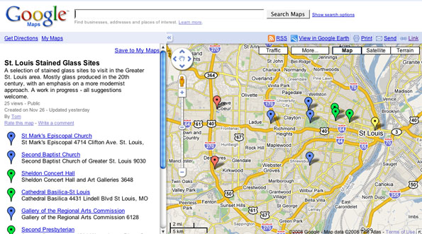
Consider this the 'beta' version. There will be changes.
All suggestions welcome.